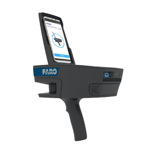
Faro Scan Plan
For fast, accurate capture of any 2D, as-built floor plan
Previous
Next
Overview
Sometimes you need to quickly document the floor plan of a building, either for public safety needs or as the basis for renovation or expansion. The FARO ScanPlan 2D Handheld Mapper makes it easy — just attach your phone and start scanning. Lightweight and easy to operate, the ScanPlan captures complete 2D floor plans and high-res complementary data in as much time as it takes to walk through the building.
Business Value of the ScanPlan
- Improve Safety and Rescue Efforts : The ScanPlan helps create pre-incident plans that account for every hidden part of a building.
- Ensure Quote Accuracy : Accurate building details mean accurate quotes and estimates for renovations and expansions.
- Drive Confidence : Data accuracy brings a new level of confidence to your work.
- Reduce Costs : Eliminating the risks associated with inaccurate floor-plan visualizations reduces rework and costs.
ScanPlan Features
- Portability : Carry the lightweight device easily with one hand.
- Familiar Interface : Interact with the ScanPlan much as you would a smartphone app.
- Real-time Visualization : See what you capture as you scan.
- Additional Documentation Capabilities : Easily add photos and annotations.
- Ability to Capture Multiple Floors : Organize all the data for one building within one project.
- Extended Scanning Time : Keep scanning with long-life batteries that swap out easily.
- Smartphone Compatibility : Control the ScanPlan with your iPhone or Android phone.
- Scan Assist : Automatically calculate the best scanner position.
- Project Sharing : Easily export projects, images and documents as DXF, PDF or ESRI Shape files for use in GIS systems. Export the 2D map as a point cloud into CPE, PLY and XYZ. Upload to 2D floor-plan software programs such as SCENE Software, and FARO Zone 2D Software, as well as WebShare.
- Pre-placement of 3D Scans : Integrate with select Focus Laser Scanners to pre-place 3D scans on-site.
- 360° Panoramic Images : Add panoramic images to the 2D map.
- Virtual Reality Mode : Export the project and the panoramic images into present4D VR Suite for the best user experience.
Public Safety Analytics Applications
- Forensic Analysis and Pre-incident Planning : Capture accurate building plans for threat assessments, safety planning, protective advances, high-profile events, arson investigation, crime scene investigation, forensic reconstruction and failure investigation.
Architecture, Engineering and Construction (AEC) Applications
- Fast, Accurate As-built Capture and Modeling : Document construction sites and buildings by capturing 2D floor plans that can be used for project evaluation, conceptual design and BIM, real estate and facility management, as well as exposé creation and presentation. Plus, use the ScanPlan to help plan for 3D scans made with Focus Laser Scanners.
- Design Layout and Projection : Quickly document site conditions and receive immediate information about the size of a scan job, the number of laser scans needed, and ideal scan positions. Information can be used for more efficient effort estimation and quotation. Quickly document site conditions and receive immediate information about the size of a scan job, the number of laser scans needed, and ideal scan positions. Information can be used for more efficient effort estimation and quotation.
- Digital Twin for Asset and Facility Management : Capture building data for use in a digital twin, which allows for operating smart factories and simulating future changes, upgrades and expansions.