Ryno UAV
The Mapping Maestro
Previous
Next
Overview
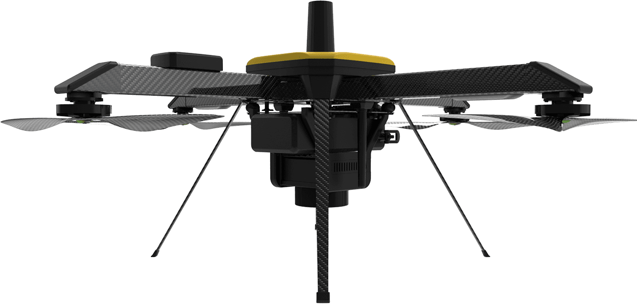
RYNO is ideaForge’s micro category survey-grade drone designed and specialized for mapping applications. It is equipped with an advanced mapping payload and ideaForge’s state-of-the-art- PPK module to deliver superior results. Due to its high accuracy in mapping applications, it is the only micro category drone that has been approved by the Survey of India (SOI) towards the Swamitva Yojana, which is set to be one of the largest drone-powered mapping projects in the world.
Features of Ryno UAV
- SOI Quality : ideaForge family of survey-grade mapping drones are qualified by Survey of India (SOI) for Swamitva Yojna
- Superior Accuracy : <5 cm in X & Y-axis and <10 cm in Z-axis with survey-grade PPK Module
- Robust Build Quality : RYNO airframe is built for over 2000 mapping operations
- Best-in-Class Area Coverage : Fly longer and farther for quicker ROI
- Terrain Avoidance : Safely conduct surveying operations in tough weather and terrain conditions
- Compliant With Air Travel : With the rating less than 100 watt hrs, RYNO battery can be hand carried in flight for easy transportation
Technical Specifications
- UAV Weight with battery and max. payload : <2 Kg
- Range of live transmission (LOS) : 4 km (un-obstructed & interference free)
- Typical Cruise Speed : 10 m/s
- Functional Temperature Range : -10°C to +50°C
- Dust & Drizzle Resistance : IP53 rating
- Deployment Time : <10 minutes
- Packaging and Storage : Backpacks to carry all mission critical components
- Regulatory Compliance : NPNT Ready – applicable for Indian airspace
Switch UAV Applications
- Railways : Inspect railway infrastructure, map project areas and conduct surveillance with ease
- Solar Energy : Identify faulty panels and conduct preventive maintenance easily for maximum power output
- Oil & Gas : Improve site safety and reduce inspection and maintenance costs
- Forest & Wildllife : Conduct zero-intrusion research and provide unprecedented protection to forest and wildlife
- Power Transmission : Inspect transmission towers and distribution infrastructure with higher speed, efficiency and safety
- Wind Energy : Access hard-to-reach systems easily and identify potential points-of-failure
- Construction : Plan and monitor projects and inspect hard-to-reach areas
- Mining : Optimize drilling and blasting, stockpile estimation and reduce environmental impact